![]()
Width: 120mm (4¾")
Height: 170mm (6¾")
Depth: 20mm (¾")
Interior Lined
Page Count: 176 Pages
Closure: Elastic Band
GSM (paper weight): 85
Cover: Hardcover
More Features
Materials
First introduced in 1994, the original Early Cartography series included reproductions of four spectacular maps produced in the Dutch Golden Age, a period of the Netherlands’ dominance in seafaring, trade, science, military and art. With this new Early Cartography release, we are bringing back into the spotlight the skill and imagination of those 17th-century Dutch cartographers.
During the 1600s, this region of Europe was experiencing a cultural and economic boom largely spurred on by the Dutch expansion overseas. Enthusiasm for geography was felt across the whole of Dutch society. In this environment, mapmaking took on a greater artistic and decorative character.
Cartography was now not only a source of essential practical tools; it was also a form of art that fused together scientific knowledge, accurate representation, æsthetic appeal and an individual mapmaker’s creative expression. Distinguished artists, engravers, typographers and publishers put the cities of Antwerp and Amsterdam on the cartographic map.
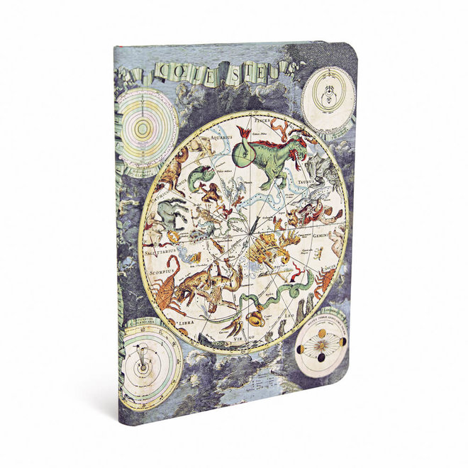
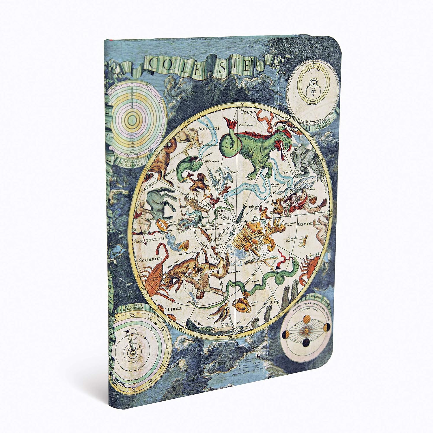
Frederik de Wit's maps had a distinct decorative flair which made them very popular with the public. Populated with fantastical creatures representing the zodiac signs, De Wit’s colourful sky map is an object of great beauty, but its importance went beyond æsthetic pleasures.
In a time when seafarers and scientists depended on their ability to identify stars and their position in the sky, star charts were indispensable as navigational and scientific study tools. Also depicted on De Wit’s chart are six diagrams representing different conceptions of the universe, including the Copernican heliocentric theory that wasn’t widely accepted until much later.
During the Dutch Golden Age, the best cartographers succeeded in creating maps equally able to serve a useful function and please art lovers. Along the same lines, we at Paperblanks have always endeavoured to create products that are as useful as they are beautiful.